• Skip to primary navigation
  • Skip to main content
  • Skip to primary sidebar
Far Western

Far Western

Far Western Anthropological Research Group, Inc., is a leader in cultural resources management services. Since 1979, Far Western has consulted in archaeological projects for private industry, government agencies, tribal organizations, and non-profit groups, to achieve the broader goals of the environmental review and compliance process.

  • SERVICES
    • Archaeobotanical Analysis
    • Artifact Analysis and Collections Management
    • Bioarchaeology
    • Effects Mitigation
    • Environmental Planning Support
    • Evaluation and Testing
    • Geoarchaeology
    • GIS and Cartography
    • Historical Archaeology
    • Inventory
    • Monitoring
    • Paleontological Services
    • Public Outreach and Interpretation
    • Sensitivity and Constraints
    • Tribal Liaison
    • Underwater Archaeology
    • XRF Lab and Sourcing Studies
  • OFFICES
    • Contact Us
    • Main Office – Davis, CA
    • Bay Area Branch – Sausalito, CA
    • Desert Branch – Henderson, NV
    • Great Basin Branch – Carson City, NV
  • STAFF DIRECTORY
    • Full Directory
    • Far Western Principals
    • Principal Investigators
    • Geoarchaeologists
    • Historical Archaeologists
    • Senior Archaeologists
    • Staff Archaeologists
    • Laboratory and Collections Management
    • GIS and Cartography Specialists
    • Data Management
    • Bioarchaeologists
    • Graphic Design and Publishing
    • Administration
  • PUBLICATIONS
    • Our Publications
    • Selected Citations
  • ABOUT ARCHAEOLOGY
    • What is Archaeology?
    • Featured Videos
    • Public Outreach and Interpretation
    • Featured Projects
    • Visualization Gallery
  • NEWS
    • News Posts
    • Far Western Occasional Speaker Series
    • Subscribe to Far Western News
  • JOB POSTINGS

Great Basin

Far Western receives the Presidential Special Achievement Award

Kaely Colligan · December 27, 2018 ·

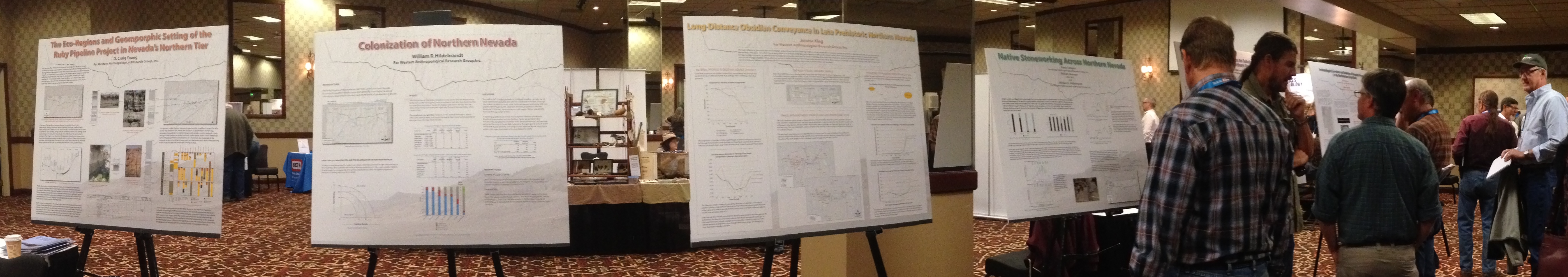
Salt Lake City, Utah – Far Western received the Presidential Special Achievement Award for Excellence and their Numerous Significant Contributions to Archaeology and CRM in the Great Basin and Beyond. The award was announced at the biennial Great Basin Anthropological Conference in October.


There are those who do what needs to be done to meet the law or the contract and those who go the extra mile and strive to make a contribution that influences both theory and method, and ultimately our understanding of the past, as well as sharing our story with the public. This year’s Presidential awardees exemplify the best in Cultural Resource Management. – Kirk Halford, GBAA President


We thank the Great Basin Anthropological Association for this honor. We dedicate this to our Far Western team, everyone contributes to this kind recognition.

Far Western at the 35th Great Basin Anthropological Conference

Kaely Colligan · November 21, 2016 ·

GBAC 2016

October 6th – 9th 2016: Far Western researchers, along with colleagues from across the nation, gathered to present recent research and share ideas at the 35th Great Basin Anthropological Conference in Reno, Nevada. Organized around a conference theme of “Featured Landscapes of the Great Basin”, archaeologists from Far Western presented or contributed to nineteen paper and poster presentations. These included a poster symposium organized by Bill Hildebrandt highlighting the Ruby Pipeline Project, a plenary presentation by D. Craig Young, and new research from the Lincoln County Archaeological Initiative, the Marine Corps Air Ground Combat Center in the Mojave Desert, the Naval Air Station Fallon, and the Soldier Meadows Area of Critical Environmental Concern. A full menu of Far Western presentation abstracts and viewable posters is provided below.

The Great Basin Anthropological Conference is organized biennially by the Great Basin Anthropological Association – Far Western’s President, Kim Carpenter, serves as Treasurer on the association’s Board of Directors. Conferences such as the GBAC are great opportunities for archaeologists, historians, ethnographers, native communities, and regulatory agencies to present and discuss new research and future directions.

A special thank you to our Art Director, Tammara Norton, for assistance with our 2016 GBAC presentations.

Papers

Spoiler title
Preliminary Findings on the Paleoindian Archaeology of Cave and Lake Valleys
Daron Duke and D.Craig Young
Far Western is conducting surveys in Cave and Lake Valleys as part of a LCAI Round 7 project to develop a Paleoindian Archaeological Context. Using both random and nonrandom sampling methods, the fieldwork is designed to test the predictions of a GIS-based model for the decline of Great Basin pluvial lakes and, by extension, the wetland habitats surrounding them. We infer that the Paleoindian record associated with short-lived lakes, such as Lake Cave in Cave Valley, would be more restricted to an early Paleoindian record than that associated with enduring lakes, such as Lake Carpenter in Lake Valley. Observing the differences between these neighboring basins will inform the broader regional issue of how and when Paleoindian peoples responded to the ultimate demise of the basin wetland habitats central to their land use strategy.
Michael Lenzi
Results of Experiments with Replicated Crescents to Evaluate Proposed Functions
Michael Lenzi
This paper presents results from a series of experiments involving replicated crescents to evaluate some of the more common hypotheses proposed for the function of crescents and gain a better understanding of their role in the prehistoric toolkit. Crescents were used to cut leather, scrape willow, and tip projectiles thrown at targets. Models from human behavioral ecology were applied to evaluate the efficiency of crescents for each task. Additionally, the breaks that accrued from use on the replicated crescents were compared to archaeological patterns. Results from this study indicate that the primary function of crescents for cutting and slicing tasks and scraping plants is not supported; however, use as transverse projectile points is well-supported.
Michael Lenzi and Vickie Clay
New Obsidian Sources, Conveyance Zones, and Toolstone Profiles from Southern Lahontan Valley and Rawhide Flats, NAS Fallon, Churchill County, Nevada
Michael Lenzi and Vickie Clay
Sourcing of obsidian nodules collected during evaluation of sites on one Naval Air Station Fallon training range in southern Lahontan Valley identified three previously unknown obsidian sources. These new sources are designated Dead Camel Mountains, Desert Mountains, and Lahontan Valley. Chemical ascription of temporally diagnostic obsidian projectile points from 29 sites in southern Lahontan Valley and Rawhide Flats generally demonstrate foragers had very large conveyance zones during the Paleoindian Period, with decreased conveyance zones through time. Lithic material type profiles for projectile points, tools, and debitage found on these sites located in two adjacent valleys show measurable differences in toolstone use that may represent different proximities to sources and/or different types of land use.
Kelly McGuire and William Hildebrandt
Taking Stock: A Far Western Perspective of Native America and CRM in the Great Basin
Kelly McGuire and William Hildebrandt
The Native American voice within the institutional and regulatory framework of Great Basin CRM has rightfully increased through the last several decades. While a number of successes can be pointed to, much of the current status of this relationship remains challenging, and sometimes contested. While Far Western must navigate this landscape, we also have a unique perspective, as we work directly with Native Americans, mostly younger people, actually doing archaeology. This experience has proven positive and occasionally transformational for both Native Americans and archaeologists. We advocate for the expanded participation of Native Americans at all levels of the archaeological enterprise.
Adrian Whitaker and Jeffrey Rosenthal
Delayed Adoption of Intensified Hunter-Gatherer Subsistence Strategies and the Continued Utility of the Traveler/Processor Model to Explain Changes
Adrian Whitaker and Jeffrey Rosenthal
Bettinger and Baumhoff’s Traveler/Processor Model was a crucial contribution to Great Basin archaeology nearly 35 years ago and the model continues to bear theoretical fruit today. This paper examines how people living in large villages with intensified economies in California’s Great Central Valley co-existed with less-economically intensive adaptations in the adjacent Central Sierra Nevada Foothills for nearly 4,000 years despite consistent contact between the two. In this paper, we examine how the adjacent regions had such different trajectories of economic intensification. We outline how a combination of new technology and climatic instability changed the relative suitability of processor economic strategies and led foothill foragers to shift to a more valley-like adaptation. More generally, the model provides a framework to explaining the coexistence of neighboring but dramatically different economies – for instance foragers vs. farmers – despite contact, as well as the mechanisms that might catalyze a shift from one economy to another. 
Justin Wisely
Crazy Little Thing Called Starch: Starch Grain Analysis of Bedrock Mortars
Justin Wisely
Starch grain analysis is an underutilized non-destructive method for improving our understanding of prehistoric plant usage, previously only utilized as a laboratory technique. As part of a larger landscape sampling for my master’s thesis at California State University, Chico, I sampled bedrock mortars at CA-ALP-156 and CA-ALP-171 in the Sierra Crest using the in-field extraction method I developed. This research covers the development of the reference collection, the creation and application of this new in-field sampling technique, and subsequent results. As the sampling of bedrock mortars is only one of the many potential uses for this non-destructive technique, there will be a discussion of future research avenues made possible by bringing starch grain sampling out of the lab and into the landscape. 
D. Craig Young
Deep in the Dust: Archaeological Landscapes in Tons per Year
D. Craig Young
The search for early archaeology in the Great Basin has shifted from a focus on prominent lacustrine features (e.g., spits and strandlines) to zones of potential resource productivity, especially basin-margin and deltaic wetlands. While theoretically smarter, we have made our work more difficult – these once expansive landforms may now be buried deep in dust. Bounded only by wind, dust transport and deposition are truly landscape-scale phenomena. Primary dust deposition can be measured today in tens of tons per acre per year. In the drying Late Pleistocene-Early Holocene transition, dust production and deposition may have been an order of magnitude greater. Eroded from hundreds of drying basins, eolian dust was deposited as vast silt plains or recycled into expansive distal reaches of alluvial fans. Reworked dust, as loess or alluvium, often forms temporally undifferentiated playa-like deposits, where we continue our hopeful searches – this silt-capped, reworked landscape may be too young. Temporally constraining dust episodes while identifying and investigating dust-infused landforms reveals potentially stratified paleo-landscapes, thereby narrowing our search for significant Paleoindian archaeology in the Great Basin. 

Posters Click on Title Link to View Poster

Ryan Byerly
Hunter-Gatherer Sites on the Pisgah Crater Lava Flow near Lavic Lake, San Bernardino County, California
Ryan Byerly
Far Western’s National Register evaluations of archaeological sites on the Pisgah Crater Lava Flow, adjacent to Lavic Lake aboard the Marine Corps Air Ground Combat Center in Twentynine Palms, California, reveal that hunter-gatherers utilized the many natural shelters created by collapsed lava blisters and tubes within the flow as settings for short term camps in support of regional resource pursuits. This poster summarizes data gathered from limited test excavations and collections of these lava flow sites and compares them to similar data gleaned from other local sites to frame a coherent picture of regional site use as a foundation for the construction of a Base-wide hunter-gatherer settlement-subsistence model.
Ryan Byerly, Lindsey Daub, Eric Gingerich, and Joanna C. Roberson
Modeling Mojave Desert Hunter-Gatherer Settlement and Subsistence from Lava Flow Sites Aboard the Marine Corps Air Ground Combat Center, San Bernardino County, California
Ryan Byerly, Lindsey Daub, Eric Gingerich, and Joanna C. Roberson
Throughout prehistory, that portion of the south-central Mojave Desert now encompassed by the Marine Corps Air Ground Combat Center appears to have largely supported short term hunter-gatherer occupations linked to the procurement of locally available jasper and chalcedony. Here, we specifically examine and compare data gathered from Far Western’s National Register evaluations of sites on the Pisgah Crater and Amboy Crater lava flows to model broader-scale settlement and subsistence patterns of the hunter-gatherers that preferentially exploited these toolstone, primarily as evident during the Late Holocene.
Daron Duke, D.Craig Young, Sarah Rice, Jaynie Hirschi, and Anya Kitterman
The Wishbone Site: An Early Paleoindian Waterfowl Cooking Feature from the Great Salt Lake Desert
Daron Duke, D.Craig Young, Sarah Rice, Jaynie Hirschi, and Anya Kitterman
Recent survey on the Old River Bed delta yielded a charcoal-rich feature containing burned waterfowl bones and debitage. The feature is eroding from the playa surface and is surrounded by an associated concentration of stone tools, including Haskett projectile points. It is over 12,000 years old. Artifacts were found both on the surface and buried. In this poster, we provide details, including radiocarbon dates, faunal and macrobotanical evidence, and lithic analysis. 
Tucker Orvald and Kathryn Ataman
Surface Archaeology of the Soldier Meadows Area of Critical Environmental Concern (ACEC), Humboldt County, Nevada
Tucker Orvald and Kathryn Ataman
Located in the Black Rock Desert-High Rock Canyon National Conservation Area, the Soldier Meadows ACEC is an exemplary locality given its unique hydrological, biological, and cultural features. Between 2013 and 2014, the BLM Black Rock Field Office directed Section 110 inventory aimed at formally documenting cultural resources within the 2,078- acre ACEC. Surface archaeology includes a near-continuous distribution of early through late Holocene flaked and ground stone accumulations as well as historic-era Emigrant Trail evidence, a stage and freight transportation corridor, and extensive ranching infrastructure that reflects homestead- through corporate-scale land use. An understanding of the surface archaeology in the ACEC will allow for long-term adaptive management, provide a resource for problem-oriented archaeological research, and help the BLM conserve this unique setting and its pervasive archaeological record.
D. Craig Young (Contributor)
Prearchaic Adaptations in the Central Great Basin: Preliminary Findings from a Stratified Open-Air Site
Brian F Codding (University of Utah), David W. Zeanah (California State University, Sacramento), D. Craig Young (Far Western Anthropological Research Group, Inc.), Joan Brenner Coltrain (University of Utah), Erik P. Martin (University of Utah) and Robert G. Elston (University of Utah) 
Early Holocene occupants of the Great Basin preferentially occupied highly productive habitats surrounding pluvial lakes. While growing evidence details the adaptations of these Prearchaic foragers in the Eastern and Western Great Basin, our understanding of the Central Great Basin remains impoverished, largely due because of the limited number of stratified archaeological sites containing well preserved material suitable for faunal analysis and radiocarbon dating. However, recent investigations of an open-air site along the northern shore of Pleistocene Lake Gilbert in Grass Valley, Nevada have revealed a buried deposit with preserved organic material associated with Prearchaic technology. Here we report preliminary analyses examining the chronology, subsistence, and technology associated with the site. Geoarchaeological analyses of soil map units and landforms suggest that similar sites are likely to be found elsewhere in Grass Valley. These findings help clarify our view of Prearchaic foragers in the Central Great Basin and expand our understanding of the earliest adaptation in the region.


A Behavioral Ecological Frame of Reference for Investigating Prearchaic Adaptations
David W. Zeanah (California State University, Sacramento), Brian F. Codding (University of Utah), Amber Johnson (Truman State University), Robert G. Elston (University of Nevada, Reno), and D. Craig Young (Far Western Anthropological Research Group, Inc.)
Occupants of the Great Basin 13-8 kya cannot be understood by direct analogy with ethnographic Great Basin foragers because they lived in climatic circumstances and at population densities utterly unlike those of recent times. Archaeological evidence suggests that hunter-gatherers were highly mobile with hunting oriented lithic technology lacking milling equipment, but acquired a broad spectrum of faunal prey and tended to camp near wetland environments. Here we develop expectations about the range of hunter-gatherer adaptations feasible under climatic scenarios for the Pleistocene-Holocene Transition as inferred from paleoenvironmental proxies. Using the marginal value theorem and theoretical expectations of sexual division of labor, we evaluate the range of subsistence and mobility evident in Binford’s ethnographic database under similar environmental parameters. This serves as a framework for casting specific expectations for Grass Valley, Nevada in context of broader Pre-archaic subsistence-settlement in the western and central Great Basin.

Poster Symposium Click on Title Link to View Poster

Prehistory of Nevada’s Northern Tier: Highlights from the Ruby Pipeline
Project Organizer: William R. Hildebrandt
Kaely Colligan, William Bloomer, and William Hildebrandt
Native Stoneworking Across Northern Nevada
Kaely Colligan, William Bloomer, and William Hildebrandt
Interesting characteristics from flaked stone assemblages recovered during the Ruby Pipeline project portray varied production patterns across the northern swatch of Nevada. Single-component assemblages reveal a transition from obsidian dominate landscapes in the west to cryptocrystalline silicate areas in the east over time. Data from these areas support several trans-Holocene changes in tool stone selection, production intensity, and reduction strategies which can be linked to broader changes in demography, land-use patterns, and work organization – most notably, the changes that occur late in time when the intensity of flaked stone production crashes and people’s interest in biface reduction declines as well. 
William R. Hildebrandt
Colonization of Northern Nevada
William R. Hildebrandt
The Ruby Pipeline corridor passes through four major habitat zones. Maximum resource productivity occurs in the west, and declines when moving in an easterly direction. Consistent with the expectations of Ideal Free Distribution modeling, the most productive zones were occupied first, followed by the infilling of the others over time. This sequence of settlement remained in place until about 500 years ago when long term habitat rankings were up ended, and the lower ranked eastern zones saw higher population densities than the western areas for the first time in prehistory. This radical change is linked to the more intensive use of small seeded plants with new technological systems brought to the area by the Western Shoshone. 
Jerome King
Long-Distance Obsidian Conveyance in Late Prehistoric Northern Nevada
Jerome King
The huge database of geochemically sourced obsidian artifacts from the Ruby Pipeline provides a unique perspective on changing patterns of prehistoric obsidian procurement and conveyance in the northern Great Basin. One of the most striking trends is an increase in obsidian source diversity in the Late Prehistoric period, driven by increased representation of distant obsidian sources. Average transport distances, as quantified both by diagnostic projectile points and by samples of debitage from dated site components, are by far the highest in the Late Prehistoric period. Local sources still dominate obsidian source profiles, as they do in earlier periods, but the increase in the representation of far-distant sources is dramatic. The apparent timing of this shift, as well as the very long distances involved, suggest that obsidian may sometimes have been transported by Native traders on horseback.
Kelly McGuire and Nathan Stevens
The Archaeological Correlates and Evolution of Geophyte Procurement in the Northwestern Great Basin
Kelly McGuire and Nathan Stevens
The economic importance of geophytes along the northwestern rim of the Great Basin is such that the entire region has been broadly categorized as the “root complex” by Catherine Fowler. However, the archaeological manifestations of geophyte gathering, processing, storage, and consumption are not well understood. Here, we review assemblages recovered from prime geophyte habitat in the Barrel Springs area in an effort to correlate certain tool types with productive geophyte zones, and to establish a settlement context of geophyte use. Particular attention is given to formed and simple flake tools and their role in the manufacture and maintenance of digging sticks, a central element of the geophyte harvest. We then discuss the energetic returns associated with geophyte procurement and its role in foraging systems through time in this region. 
Allika Ruby and Jerome King
Landscape Analysis of Pronghorn Trap Features in Eastern Nevada
Allika Ruby and Jerome King
A Landscape Analysis of Pronghorn Trap Features in Eastern Eastern Nevada contains the remains of many large wooden enclosures that were thought to have been used by prehistoric hunting groups to capture pronghorn. These enclosures, or corrals, display highly similar characteristics which reflect their builders’ sophisticated understanding of pronghorn behavior. Researchers from Far Western Anthropological Research Group, Inc., conducted a detailed analysis of the construction techniques used to build four such enclosures along the Ruby Pipeline corridor near Montello. Our study indicates that the builders intentionally integrated features of the landscape into the corrals that likely increased their effectiveness. Our presentation highlights the characteristics shared by the four prehistoric corrals as well as a nearby historic-period corral, compares them to other documented pronghorn corrals in the region, and offers a predictive model for locating additional corrals. 
Andrew Ugan and Laura Harold
Large-Scale Perspectives on Subsistence Stability Across the Northern Great Basin
Andrew Ugan and Laura Harold
Substantial attention is paid to prehistoric big game use in the western U.S., especially as it relates to changes in climate, hunting pressure, or the social contexts of foraging. However, many such studies are tightly focused, sometimes site-specific affairs. Here we take a broad look at big game use by summarizing faunal assemblages from 153 sites across the northern Great Basin. We show that while there is huge variation in site-specific reliance on big game within time periods and an increase in the frequency of large animals between the Paleoarchaic and later periods, the overall array or resources taken is generally broad and there is little difference in mean reliance on big game from the Early Archaic onwards. These data suggest broad stability in hunting patterns, and we discuss the reasons for the observed pattern, its generality, and its implications. 
D. Craig Young
The Eco-Regions and Geomorphic Setting of the Ruby Pipeline Project in Nevada’s Northern Tier
D. Craig Young
The varied landforms of Nevada’s Northern Tier provide context for understanding the archaeological patterning that forms the basis for interpreting the human past in the vicinity of the Ruby Pipeline Project – research presented in this poster session. Eco-regions defined by modern floral communities and geologic units are the starting point, and these are viewed through a lens of late Pleistocene to Holocene landscape evolution. Geomorphological investigation of local landforms and regional geomorphic process included documentation of 25 alluvial profiles at 15 study locations in eleven hydrologic basins. These localities inform a model of changing conditions in alluvial systems across the Northern Tier.  

Far Western Crew Unearths 12,300-Year-Old Hearth in Utah

Kaely Colligan · August 25, 2016 ·

Overview fish eye
Excavation overview of the Wishbone site, Utah. Photo Credit: Todd Cromar

Last summer, a crew of Far Western archaeologists working on the Hill Air Force Base, in compliance with Section 106 of the National Historic Preservation Act, sunk a 50-x-50-cm test probe into Utah’s arid ground and turned up something you would not expect to find in the desert: waterfowl bone. These were burned within a Paleoindian hearth now radiocarbon dated to 12,300 calendar years ago.

After exposing the remains, Principal Investigator Dr. Daron Duke, with Senior Archaeologist Sarah Rice, and Senior Geoarchaeologist Dr. D.Craig Young quickly realized they were uncovering evidence of a marshland landscape in the middle of the modern desert and life-ways of North America’s earliest inhabitants never seen before. They had discovered the oldest open-air hearth ever found in the Great Basin and the first known Ice Age camp for hunting and cooking exclusively waterfowl.

Excerpt from Dr. Duke’s field notes July 11, 2016 “Amazing day. Mike L. excavated a pristine Haskett point one cmbs and about 1 meter from the feature…
Excerpt from Dr. Duke’s field notes July 11, 2016
“Amazing day. Mike L. excavated a pristine Haskett point one cmbs and about one meter from the feature…”

In July, meticulous excavation fully exposed the hearth and its surrounding area. The team found thousands more waterfowl bone fragments and several stone tools, including an in situ Haskett projectile point discovered just one centimeter beneath the ground surface and one meter from the hearth.

Soil samples of the hearth’s contents were collected in the field and brought back to the Far Western archaeobotanical laboratory for flotation processing and analysis. The archaeobotanical team recovered charred remains of willow wood, and seeds of bulrush, pond weed, and tobacco. The tobacco seeds are thought to be the oldest ever found in North America, nearly 9,000 years older than previous finds in New Mexico and Bolivia. Archaeobotany Director Dr. Eric Wohlgemuth further elaborates on the implications of these finds:

The charred remains are representative of the ancient environment and the bulrush and pond weed seeds could be waterfowl stomach contents. While willow wood charcoal was found in this context, willow is absent from the local environment today.

Flotation process
Flotation process to recover charred plant remains. Photo Credit: Angela Arpaia


A press release of the discovery soon hit the internet entitled, Archaeologists Discover Proof of Wetlands, Ancient Life on the Utah Test and Training Range.

The story was also picked up by Western Digs, an online science news site focusing in archaeology, anthropology, and paleontology of the American West and by Standard-Examiner, a local daily news source in Utah.


Rare Utah Finds Continue to Make News

Molly · April 14, 2015 ·

Western Digs‘ new article “Over 1,000 Ancient Stone Tools, Left by Great Basin Hunters, Found in Utah Desert” cites Far Western’s work in the Utah Test and Training Ranges in 2012. The article mentions the vast assemblage of stone tools found in the Old River Bed Delta of Western Utah—including the largest Haskett Point ever recorded. Daron Duke, Principal Investigator and Director of our Desert Branch, mentions in the article that, regardless of its size, the “Haskett is very rare anywhere.”

“(T)hese finds help clarify a picture that has remained hazy for archaeologists: the life and times of the Great Basin’s earliest inhabitants, who may have been contemporaries of the ancient and widespread Clovis culture.” -Blake de Pastino, Western Digs

Check out the full article and photos HERE.
This find was also mentioned on the website of Archaeology Magazine.

Haskett Point 3D Model Below:

Supported Browsers: Safari, Mozilla Firefox, and Google Chrome.
ROTATE: Click and drag (or touch and drag). ZOOM: Scroll wheel (or pinch and zoom).


SHARE THIS: Share on Facebook Share on Google+ Share on LinkedIn Email this to someone

Primary Sidebar

CONTACT US TODAY

Main Office - Davis, CA
(530) 756-3941
Bay Area Branch - Sausalito, CA
(415) 413-1450
Desert Branch - Henderson, NV
(702) 982-3691
Great Basin Branch - Carson City, NV
(775) 847-0223

FEATURED

Visualizing Indigenous Persistence during Spanish Colonization of the San Francisco Bay Area

FAR WESTERN NEWS

McGuire Publishes in Terrain

February 15, 2024

Vickie Clay awarded the NAA Silver Trowel Lifetime Achievement

May 17, 2023

Archaeology Reveals Past Lives of Bay Area Native Tribe: Phil Gross and Far Western Produce National PBS Documentary

November 8, 2022

SUBSCRIBE TO FAR WESTERN NEWS

QUICKLINKS

Statement of Qualifications
GSA Contracting
Current On-Call List
Contact Us
Awards

SPECIAL SERVICES AND EVENTS

XRF Laboratory
Archaeobotanical Analysis
Underwater Archaeology
Public Outreach and Interpretation
Tribal Liaison
Occasional Speaker Series

CONTACT US

Main Office – Davis, CA (530) 756-3941
Bay Area Branch – Sausalito, CA (415) 413-1450
Desert Branch – Henderson, NV (702) 982-3691
Great Basin Branch – Carson City, NV (775) 847-0223

Far Western

Copyright © 2025 Far Western · Crafted by Tangerine Design · Log in

  • Statement of Qualifications
  • GSA Contracting
  • Current On-Call List
  • Contact Us
  • Awards