• Skip to primary navigation
  • Skip to main content
  • Skip to primary sidebar
Far Western

Far Western

Far Western Anthropological Research Group, Inc., is a leader in cultural resources management services. Since 1979, Far Western has consulted in archaeological projects for private industry, government agencies, tribal organizations, and non-profit groups, to achieve the broader goals of the environmental review and compliance process.

  • SERVICES
    • Archaeobotanical Analysis
    • Artifact Analysis and Collections Management
    • Bioarchaeology
    • Effects Mitigation
    • Environmental Planning Support
    • Evaluation and Testing
    • Geoarchaeology
    • GIS and Cartography
    • Historical Archaeology
    • Inventory
    • Monitoring
    • Paleontological Services
    • Public Outreach and Interpretation
    • Sensitivity and Constraints
    • Tribal Liaison
    • Underwater Archaeology
    • XRF Lab and Sourcing Studies
  • OFFICES
    • Contact Us
    • Main Office – Davis, CA
    • Bay Area Branch – Sausalito, CA
    • Desert Branch – Henderson, NV
    • Great Basin Branch – Carson City, NV
  • STAFF DIRECTORY
    • Full Directory
    • Far Western Principals
    • Principal Investigators
    • Geoarchaeologists
    • Historical Archaeologists
    • Senior Archaeologists
    • Staff Archaeologists
    • Laboratory and Collections Management
    • GIS and Cartography Specialists
    • Data Management
    • Bioarchaeologists
    • Graphic Design and Publishing
    • Administration
  • PUBLICATIONS
    • Our Publications
    • Selected Citations
  • ABOUT ARCHAEOLOGY
    • What is Archaeology?
    • Featured Videos
    • Public Outreach and Interpretation
    • Featured Projects
    • Visualization Gallery
  • NEWS
    • News Posts
    • Far Western Occasional Speaker Series
    • Subscribe to Far Western News
  • JOB POSTINGS

California

Far Western Welcomes New Principal

Kaely Colligan · February 5, 2018 ·

We are pleased to welcome a new Principal to our Group: Dr. Adie Whitaker.


Adrian Whitaker Far Western Principal
Dr. Whitaker has been with Far Western since 2008 and has over 15 years of archaeological experience in California CRM.

He has authored numerous reports on the archaeology of California, while leading inventory and excavation projects from the San Francisco Bay to the Sierra Nevada to the Channel Islands. Building on data collected and collaborations formed during these projects, Adie has published numerous scholarly articles in regional, national, and international journals, including American Antiquity, the Journal of Anthropological Archaeology, the Journal of Archaeological Science, the Journal of Coastal and Island Archaeology, California Archaeology, and the Journal of California and Great Basin Anthropology.

He is Editor of the  Journal of California and Great Basin Anthropology and continues to play a strong role in the Society for California Archaeology.

Far Western will benefit greatly from Adie’s enthusiasm and leadership. We value his ability to meet the compliance needs of our clients while expanding our knowledge of California’s past. 

Far Western Receives 2017 Governor’s Historic Preservation Award

Kaely Colligan · January 12, 2018 ·

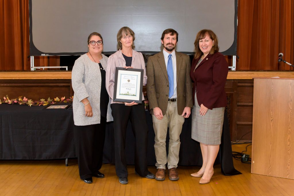
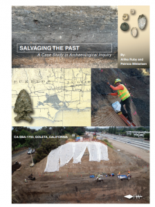
Far Western receives one of the coveted 2017 Governor’s Historic Preservation Awards for their work at archaeological site CA-SBA-1703, resulting in the document Salvaging the Past: A Case Study in Archaeological Inquiry. The California Office of Historic Preservation and State Parks and Recreation identified the document as an “excellent model for this kind of documentation and sharing of important resources.”

The report, authored by Allika Ruby and Patricia Mikkelsen, was a collaborative effort. Supporting authors included Philip Kaijankoski, Eric Wohlgemuth, Angela Arpaia, Lucas Martindale Johnson, Andrew Ugan, William Hildebrandt, John R. Johnson, and Nathan Stevens. Terry Joslin with the California Department of Transportation was involved throughout, as were Barbareño Chumash representatives who monitored all excavation work—Gilbert Unzueta, Isa Folkes, and David Dias.

Project Background

Salvaging the Past: A Case Study in Archaeological Inquiry 

The Las Vegas and San Pedro Creeks Capacity Improvements Project involved culvert replacement for flood control along US Route 101 near the city of Goleta, Santa Barbara County. A huge box culvert lay in a rechanneled drainage, stretching under railroad tracks, multi-lane Route 101, and an off-ramp. There were also two known sites either side of the highway, in a very urban environment, one occupied early in time—CA-SBA-1703—the other a named ethnographic village—S’axpilil’s (SBA-60). The sites are just north of Goleta Slough at the confluence of two creeks, an area with archaeological evidence shoring focused settlement for thousands of years.

Far Western was tasked with conducting salvage data recovery operations, within time, budget, weather, and safety constraints. The theme of the work became site persistence—

How could any intact cultural deposits survive in such an environment?

Through experience and skill, geoarchaeologist Phil Kaijankoski identified intact versus disturbed deposits. We then quickly developed a work plan to recover maximum information in a hectic environment using appropriate and diverse field techniques.

Back at the lab, we analyzed and interpreted the data, focusing on the identification of discrete temporal components. We had to determine if the deposit was associated with SBA-60 or SBA-1703; it was geographically right in-between. Geoarchaeologist Kaijankoski noted that the newly identified deposit lay on an ancient fan, as did SBA-1703, whereas SBA-60 sat on a youthful floodplain. Initial dating and artifact analyses confirmed the site deposit on the western slope was clearly associated with the older occupation at SBA-1703, dated to around 3700-2400 cal BP. A few Late Period artifacts, especially in the mixed eastern slope, indicated some overlap between the two sites.

Whistle with Asphaltum-embedded Shell. Post-900 cal BP.  Click image to view in 3D!

Public Outreach Efforts

Given diverse, abundant artifacts, along with intact features, Far Western was able to undertake in-depth analyses and focus on addressing current avenues of research. The data presentation was geared to students of cultural resource management as the project highlighted the persistence of intact cultural resources in highly disturbed environment, and innovative methods to retrieve, analyze, and document findings.

The project presented such an important learning opportunity, that Far Western felt obligated to share it as much as possible, in a format that was readable, educational, and exciting. Therefore, a visually appealing document specifically geared to archaeology students focusing on cultural resources management and contract archaeology was created.

It includes:

  • perspectives on site preservation in an urban environment
  • excavation strategies adapting to special conditions
  • local and regional environmental reconstruction focusing on Goleta Slough
  • relevance to biological, geological, archaeological, and 
  • environmental studies
  • complex kinship studies based on mission records that connect Chumash individuals from the village of S’axpilil’s to Chumash rancherias
  • innovative field techniques that adjust for conditions and findings and emphasize the importance of temporal components
  • an in-depth study of geoarchaeology, noting the importance of a study of soils and soil transitions, is important to geologists and archaeologists.

Study questions were also prepared, relating to important aspects of the field work and research. Far Western provided the report and study questions to seven regional institutions to be incorporated into lesson plans; they have already been used in several classroom settings, with positive feedback.

Another key component of the project was the presence of the local Native American community. The monitors were provided copies of the case study; each encouraged the use of Salvaging the Past in archaeology classrooms. The ethnographic studies of Dr. John R. Johnson for this project emphasize the larger social network that existed at the time. This information is only available from extensive mission record studies.


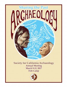
Sharing the Past – Far Western Contributes to the 51st SCA Annual Meeting

Kaely Colligan · April 3, 2017 ·

2017 SCA Program
Click image to view entire program

March 9th – 12th 2017: Braving an impending storm – fortunately, a forecast that wasn’t – over 800 archaeologists attended the 51st Annual Society of California Archaeology Meetings in Fish Camp, California, just outside Yosemite National Park on the western slope of the Sierra Nevada.

Organized by Far Western’s Dr. Adie Whitaker (Program Chair), the overarching theme of “Sharing the Past” was vibrant throughout the venue and symposia. Friday morning’s Plenary Session included a stellar line up of speakers sharing highlights of recent research in the foothills and mountains of the central and north-central Sierra. The Plenary Session officially opened the 2017 meetings as Dr. Eric Wohlgemuth of Far Western discussed the challenges of archaeological field methods in California’s conifer forests. Eric spoke alongside Diane Gifford-Gonzalez, Carly S. Whelan, Kathleen L. Hull, Reba Fuller, Brian Codding, Ron W. Goode, and Mary L. Maniery.

The meeting then dispersed into a buzz of presentations, posters, forums, and roundtable discussions. Far Western contributors and participants provided strong presence throughout the weekend.

As the meetings closed on Sunday, Far Western past-President Bill Hildebrandt took on a new presidential role, joining the SCA Board as Incoming President. Bill begins his service this year as a member of the seven-person board and will serve as President of the SCA from 2018-2019.

In addition to behind the scenes work organizing the program by Adie Whitaker, Production Supervisor Nicole Birney produced the program using a database designed by Partner Jay King. 

A special thank you to Nicole Birney and Jay King for assisting with program organization and to Tammara Norton for contributing to our 2017 SCA presentations. 

Organized Paper Symposium

Organizer: Kaely R. Colligan
Minding the Gap: New Perspectives on the Study of Gender and Archaeology
Organizer: Kaely R. Colligan
The Society of California Archaeology has chosen the theme “Sharing the Past” for the 2017 meeting, to bring the membership together and to identify what unifies the past and present. This symposium will focus on different aspects of studying gender in archaeology and how this translates to modern-day gender issues. Topics include the history of women in the field of California archaeology, feminist perspectives on archaeological thought/theory, and how prehistoric/historic gender roles are revealed in archaeological assemblages. The goal is to bring forward new perspectives on old theories, and shed light on modern issues in our field.

Organized Poster Symposium

Organizer: Allika Ruby
Salvaging the Past at CA-SBA-1703: A Case Study in Archaeological Inquiry
Organizer: Allika Ruby
In 2015, Far Western conducted salvage excavations along US 101 in Goleta after Caltrans construction workers exposed a buried portion of CA-SBA-1703. The site was an Early Period midden found within an extremely disturbed context. Departing from the traditional CRM reporting format, Far Western produced a concise volume with abundant graphics intended to be used primarily by college educators seeking to introduce their students to archaeological practices using a contemporary, realistic, and unexpected scenario. The volume highlights challenges often encountered by archaeologists working on project-driven excavations. This poster session presents selected issues and findings documented in that report.

A Time Capsule in the Center of Chaos
Patricia Mikkelsen
Interesting characteristics from flaked stone assemblages recovered during the Ruby Pipeline project portray varied production patterns across the northern swatch of Nevada. Single-component assemblages reveal a transition from obsidian dominate landscapes in the west to cryptocrystalline silicate areas in the east over time. Data from these areas support several trans-Holocene changes in tool stone selection, production intensity, and reduction strategies which can be linked to broader changes in demography, land-use patterns, and work organization – most notably, the changes that occur late in time when the intensity of flaked stone production crashes and people’s interest in biface reduction declines as well.

Changing Fishing Practices on the Shores of Goleta Slough
William Hildebrandt
Investment in boating and netting technology intensified on the shores of Goleta Slough and other central coast estuaries in the Middle Holocene. Most of this activity focused on estuary habitats, but the technology was applied to relatively deep water settings beyond the kelp beds from time-to-time as well. Exploitation of these deeper water habitats did not occur among people living in outer coast settings away from estuaries, probably because the economic returns from deeper water habitats alone did not justify the construction of watercraft required to reach them in a safe and productive manner.

Listening to the Ancestors: A Chumash ‘ich’unash at SBA-1703
Terry Joslin
A large, Late Period, deer tibia bone whistle was the first item seen by the archaeological monitor after being called to SBA-1703. Chumash informants nearly uniformly associate this type of flute with `antap ceremonies. Regional studies have identified an increase in flute size, along with deeper tones, over time, to be more effective during ceremonies where large numbers of people were present. Many of these flutes have shell beads applied to them with asphaltum, and several additionally have leather wrappings.

Where the Land Meets the Sea: Site Stratigraphy and Landscape Context of CA-SBA-1703
Philip Kaijankoski
Researchers have long recognized that some coastal estuaries have contracted during the Holocene due to sedimentation. However, the timing and maximum extent of a former estuary is difficult to determine without extensive subsurface exploration, which has not yet been conducted in the Goleta Valley. Early archaeological and geological studies hypothesized that at one time Goleta Slough covered a vast area, extending inland to CA-SBA-1703. This is despite historic mapping depicting the site several kilometers away from the estuarine margin. Through a detailed review of existing data sets this hypothesis is critically analyzed.

Mind the Gap: Field Methods at SBA-1703
Allika Ruby and Nathan Stevens
Working at SBA-1703 was not for the faint of heart. Crew members contended with a constricted work space along the margins of a yawning construction pit, hemmed in by an active railroad corridor on one side and a major freeway on the other side. Archaeologists improvised ways to safely access the preserved portions of the site without compromising scientific methods.

A Tale of Two Features: Faunal Bone Recovered from SBA-1703
Allika Ruby and Andrew Ugan
Two buried, fire-affected rock features were found only a few meters apart at SBA-1703. Each contained faunal bone and shell, as well as charred nuts and seeds. However, radiocarbon dating established they were separated in time by a span of about one thousand years. Both features demonstrate that estuarine shellfish and small schooling fishes were important dietary constituents. However, the earlier feature (ca. 3829 -3637 cal BP) shows an emphasis on islay nuts while the later feature (ca. 2750-2180 cal BP) indicates that the diet had shifted to a stronger emphasis on terrestrial game, primarily deer-sized animals.

Parallel Sequences of Marine and Plant Resource Intensification in Santa Barbara and the San Francisco Bay
Eric Wohlgemuth
Charred plant food debris and indices from the Santa Barbara mainland coast decline markedly with intensification of marine resources at about 6,000 years ago. The decline in plant vs. marine foods is strikingly similar to patterns seen about 3,000 years later on the eastern and northern San Francisco Bay shore. In both regions, plant food debris and indices increase millennia after marine food intensification, at ca. 3000 BP on the Santa Barbara coast and after ca. 1000 BP along San Francisco Bay. These patterns are relevant to the priority of aquatic faunal resources posited by Keeley (1991).

Papers

Brian F. Byrd, Patricia Mikkelsen and Shannon DeArmond

Re-visualizing Regional Indigenous Persistence—A San Francisco Bay-Delta Area Perspective for Archaeologists
Brian F. Byrd, Patricia Mikkelsen and Shannon DeArmond
This paper provides a framework, largely through modeling and visualization, on traditional indigenous village persistence in the San Francisco Bay-Delta region. We explore spatial variation in the pace of colonial impact during a 50-year period using Milliken’s Community Distribution Model of Spanish Mission baptism data. In particular, we focus on the tempo of ancestral village and abandonment, highlight areas where decades of continuity in occupation after 1776 are expected, and areas where more nuanced Native persistence is anticipated. Finally, we touch on archaeological implications of these movements and persistence, and potential approaches to investigate these complex patterns.

Kaely R. Colligan

The Working Mother: Gaining Resources and Prestige as a Prehistoric Female
Kaely R. Colligan
Men’s ability to gain prestige in their communities, primarily through hunting and other forms of resource gathering, is well-substantiated in the archaeological record. But a woman’s ability to gain prestige or authority, particularly while providing caring for offspring, is an issue that has received far less attention. An analysis of the archaeological record from a socio-behavioral perspective suggests that modern women do not have a monopoly on prestige-gathering, and that prehistoric women also exhibited competitive behavior aimed at attracting mates through the collection and storage of resources, basketry/textile design, and settlement patterns. 

Jay King

Rock Art and Archaeology of Upper Smoke Creek Canyon, Lassen County
Jay King
Smoke Creek Canyon contains an extensive complex of petroglyphs, including the “Bruff’s Rock” site, originally described in 1850 and thought to be the first California rock art ever described by a Euro-American. A recent survey reveals a rich and varied archaeological record in close association with the petroglyphs, including an extraordinary quantity of milling tools, as well as large residence-sized rock rings and other features. This close association between rock art and residential features offers the opportunity to comment on both the likely age and the social context of the rock art’s production.

Jack Meyer

Once Upon a Time with Two Cents and Three Minutes
Jack Meyer
Three-Minute Artifact Forum: Sharing the Past

Patricia Mikkelsen

What’s Left to Say about Ground Stone?
Pat Mikkelsen
Three-Minute Artifact Forum: Sharing the Past

Andrew Ugan, Katie Bonham, and Justin Wisely

Soaproot (Chlorogalum pomeridianum): Miracle Plant or Just Another Dirty Little Root?
Andrew Ugan, Katie Bonham, and Justin Wisely
Among ethnographically important California plants, soaproot (Chlorogalum pomeridianum) receives little attention, despite use as a food, medicine, mastic, dye, source of fibers, detergent, and fish poison. In an effort to explore this dichotomy we provide a quantitative assessment of soaproot’s value, detailing its nutritional composition, collection costs, and effectiveness as a toxin. We show that return rates are high and effectiveness as a fish poison low. Given these points we would expect soaproot to have been widely consumed, but almost never used as toxin. We conclude by discussing the implications of these points for our understanding of prehistoric soaproot use.

Justin Wisely
Starch Grain Analysis of Bedrock Mortars in the Sierra Nevada: Implications to Our Understanding of Bedrock Milling Features
Justin Wisely
Bedrock mortars are ubiquitous throughout California and their function has been a longstanding question for archaeologists. Many have assumed a function associated with acorn intensification, but McCarthy took the time to conduct an in-depth ethnographic study on their function. It was this work that helped inspire my own research into bedrock mortar function, and gave me a start in questioning the assumptions about other often-dismissed cultural remains such as fire-cracked rock. This paper will present the starch grain analysis of bedrock mortars research conducted for my master’s thesis that was partly inspired by McCarthy’s landmark work, and the future avenues.
Eric Wohlgemuth

Challenges to Archaeological Field Methods in the Conifer Forest: An Example from Calaveras Big Trees State Park
Eric Wohlgemuth– Plenary Session
The conifer forest zone of the Sierra Nevada can be a difficult place to do archaeology. Even for sites with well-defined component areas, the dearth of subsurface features with associated datable organics obscures accurate dating of artifact assemblages. Further, the lack of well preserved faunal remains, and the difficulty in associating plant macrofossils with artifact assemblages, limits subsistence reconstructions. Data recovery excavations at CAL-277/H at Big Trees State Park attempted to solve these problems through large block exposures, selective recovery excavation, stratigraphic excavation for fine-grained samples, large-scale flotation sampling, and starch grain recovery from bedrock milling features and grinding tools.

Posters

Angela Arpaia and Eric Wohlgemuth

CA-SCL-677: Challenging the Status Quo of Plant Use Intensification Trend in Santa Clara Valley
Angela Arpaia and Eric Wohlgemuth
Archaeobotanical remains collected from sites in Santa Clara Valley follow trends seen in sites throughout interior Central California. Early period sites exhibit generalized and balanced use of nuts and berries with minor use of small seeds, followed by intensification of acorn in Middle Period sites, culminating in intensive use of both acorn and small seeds in Late Period sites. Middle Period site CA-SCL-677 is unique in having very abundant small seeds; possible reasons for the anomaly include habitat, site use, and population density. 


To learn more, please visit the SCA Proceedings compiled by Proceedings Edtior, Allika Ruby

Cuyama Valley- A Corridor to the Past
receives the 2016 Governor’s Historic Preservation Award

Kaely Colligan · October 18, 2016 ·

Far Western was awarded one of the coveted 2016 Governor’s Historic Preservation Awards for the Cuyama Valley – A Corridor to the Past project. The California Office of Historic Preservation chose the project as an exceptional example of historic preservation efforts on behalf of California’s cultural heritage. The project, directed by Far Western Project Manager and Principal Investigator Patricia Mikkelsen, was a collaborative effort among the Native Chumash community, the District 5 Central Coast Specialist Branch of the California Department of Transportation, the Santa Barbara Museum of Natural History, Foothill Resources, and Tiley Research.

Project Background

Excavation Cuyama
Excavation of the ethnographic village of Wenexe’l taken in 1970 by Crew Chief Al McCurdy. This impressive saucer-shaped depression was characterized by burned timbers, postholes, and hearth/pit features. Recovered artifacts from within the depression included flaked and ground stone tools, shell and stone beads, modified bone, bones, shell, and historic-period material such as glass beads and roof tiles. It dates to the Late Period-Historic-era, 600 cal BP–1806 AD.

Cuyama Valley – A Corridor to the Past showcases seven archaeological sites that underwent initial salvage excavations in the late 1960s and early 1970s, with final analysis nearly 40 years later.

The California Division of Highways (precursor to the California Department of Transportation [Caltrans]) carried out three highway realignment projects along State Route 166 in Cuyama Valley. As the project pre-dated the birth of modern Cultural Resources Management practices (i.e., funding was not set aside for analysis of cultural materials unearthed during infrastructure projects), the assemblage was never formally documented. As a result, the collection sat untouched in the UC Santa Barbara archives. Dr. Valerie Levulett, Chief of the Caltrans Central Coast Environmental Specialist Branch and one of the original archaeologists who participated in the salvage excavation work, submitted a Caltrans Transportation Enhancement grant proposal to address the long-delayed processing of these important collections. With the grant approved, Far Western, under a Caltrans cultural resources on-call contract, was tasked with the challenge of not only analyzing the collection, but recreating the excavation itself through numerous field and photograph logs, field notes, and maps. Far Western also reached out to others who were part of the original project, including Dr. Jeanne Binning, Al McCurdy, and Max Farrar, to help set the scene.

Prior to this endeavor, little was known about Cuyama Valley prehistory. Minimal formal archaeological work and few publications have focused on the valley—a corridor that once connected the prehistoric population centers of the Central Valley and Central Coast. The data compilation brought to light a wealth of information about the history and lifeways of the Native people of the region.

Far Western catalogued approximately 3,000 flaked and ground stone tools, including over 400 projectile points, and nearly 5,000 shell, stone, and glass beads and ornaments. These types of discoveries allow for an array of research opportunities and contributions to the archaeology, ethnography, and history of the region.

Archaeological Contributions

  • A graphic representation of local temporal indicators across time, as well as temporal charts of local projectile point and bead types
  • Identification of, and focus on, site-specific temporal components
  • Extensive original research and discussions on landscape evolution and geoarchaeological sensitivity, including a map of buried site potential in the Caltrans right-of-way in the Cuyama Valley
  • A detailed description and discussion of a fully exposed Chumash structure
  • Analysis of yucca-roasting ovens, including feature descriptions, plant identifications, and preparation methods and resulting archaeological evidence
  • A contribution to the ongoing debate on artiodactyl abundance
  • Patterns of technology, settlement, and social interactions.


Ethnographic Contributions

  • Estimates of non-mission populations in Cuyama Valley, and the effects of European-borne diseases, especially on children
  • Discussions and complex diagrams of social interactions between Cuyama Valley inhabitants and surrounding villages
  • Detailed kinship charts of Native individuals associated with Cuyama Valley villages
  • First-hand accounts from court dockets of Cuyama Valley Native Americans in the 1840s and 1850s
  • A focus on the concerns and activities of today’s Chumash who are carrying on the traditions and languages of their ancestors


Contributions to the History of the Region

  • A documented history of Cuyama Valley’s early settlement and land use, with special reference to the occupation of sites during the Spanish and Mexican periods in California
  • Evolution of transportation corridors through the valley
  • Development of adjacent road- and highway-related features that have encroached upon the seven Cuyama Valley sites.


Cuyama Exhibit
Far Western Art Director Tammara Norton worked closely with members of the Northern, Barbareño, and Ventureño Chumash tribes to create the displays depicted above for their use in educating the public about the unique prehistory of Cuyama Valley. Each tribe received a set of three portable exhibits designed to their specifications, for public outreach and education.

Public Outreach Efforts

The project produced four genres of public-oriented interpretive material designed in collaboration with individuals from the Northern, Barbareño, and Ventureño Chumash tribes for use in educating the public about the unique prehistory of Cuyama Valley—a booklet, exhibits, bookmarks, and tool replicas.

Far Western prepared a full-color, 70-page booklet, entitled The Long Road Traveled – Archaeology, Native Americans, and Europeans in Cuyama Valley, which discusses the Cuyama Valley project, the region’s prehistory and history, Chumash culture, and living descendants. It concludes with a short glossary of archaeological terms and suggestions for further reading. Caltrans printed 1,000 booklets and distributed them free to Native Americans, Cuyama Valley residents, the Santa Barbara Museum of Natural History, and local libraries, museums, and schools.


The project could not have been accomplished without the following individuals:

Far Western

Pat Mikkelsen
Jack Meyer
Adrian Whitaker
Eric Wohlgemuth
Nathan Stevens
Deborah Jones
Molly Fogarty Starr
Tammara Norton
Elizabeth Honeysett
Laura Harold
Jill Eubanks

Foothill Resources

Julia Costello

Caltrans

Valerie Levulett
Jeannine Binning
Krista Kiaha
Paula Carr
Ed Schefter
Terry Joslin
Rochelle Vierra

Tiley Research

Michelle Tiley

Santa Barbara Museum of Natural History

John Johnson

Other Individuals

Robert Gibson
Kenneth Gobalet
Gregory White
Emma Britton
Ronald Bishop
Richard Hughes
Chester King
Jeff Parsons
Thomas Origer

FW Geoarchaeologists Help Map San Francisco Bay Area Prehistory

Molly · August 25, 2015 ·

DSC01507
Cores in the Far Western Geoarchaeology Lab.

Cores upon cores fill the shelves of the Far Western Geoarchaeology Lab in Davis. These long tubes of “dirt” tell us a lot about prehistoric landscape evolution, and thus can help determine whether or not a location might have potential for archaeological findings. In most situations, backhoe trenching is the most effective way to identify sites. When backhoe trenching is not possible, in urban areas for example, or when the potential depth for a site exceeds the range of mechanical excavation, we conduct hydraulic continuous-core sampling to identify sites.

Coring in San Francisco.


When archaeologists dig through the layers of earth carefully, the different soils and buried surfaces can be visually seen. Cores do the same thing, like inserting a straw into a layer cake, sometimes reaching 65 feet below surface. Each four-foot section of the core is pulled up in two-inch-diameter plastic liners, brought to the lab, sliced down the center, and splayed open to reveal the stratigraphic layers.

DSC01511
OSL samples from cores.

Dating the layers can be done in a couple of ways. Most often, radiocarbon dating is used to get close estimates of how old plant, bone, or shell is in a certain layer, or when now buried surfaces were exposed at the surface. Other times, however, there is not enough organic matter to be sampled. In those cases, Optically Stimulated Luminescence (OSL) dating can be used. OSL samples must be removed from their original location in complete darkness, and kept in the dark until tested to provide accurate dates. The dates for each layer let geoarchaeologists map similar types of strata throughout a particular location. This helps archaeologists figure out where sites might be buried.

Schematic Cross Section of Study Area in San Francisco.


Recently opened core exposing artificial fill at the surface (~1.5–2.4 meters below surface), underlain by recent alluvium (~2.5–3.5 meters below surface), and followed in turn by a dense prehistoric shell midden (~3.5–5.5 meters below surface) formed on a Pleistocene-age sand dune (starting ~5.5 meters below surface).


Once buried land surfaces are identified in the cores, they can be sampled to not only determine their age and whether they contain archaeological materials, but also tested to see what types of small seeds, pollen, or other diagnostic material. This can be used to reconstruct the type of landscape that was present when that layer was at or near the surface.

Currently, Far Western Geoarchaeologists are using cores to map the potential for intact buried land surfaces below the historic-era extent of the San Francisco Bay. As ocean levels have risen, they have covered up landforms where people once lived. Recent findings indicate that we may be able to quite accurately map where some people lived for long periods of time, and perhaps returned over and over again generations later.

For interested archaeologists and non-archaeologists alike, we suggest reading: Waters, Michael R.,1992, Principles of Geoarchaeology: A North American Perspective. The University of Arizona Press.

SHARE THIS: Share on Facebook Share on Google+ Share on LinkedIn Email this to someone
  • Page 1
  • Page 2
  • Page 3
  • Go to Next Page »

Primary Sidebar

CONTACT US TODAY

Main Office - Davis, CA
(530) 756-3941
Bay Area Branch - Sausalito, CA
(415) 413-1450
Desert Branch - Henderson, NV
(702) 982-3691
Great Basin Branch - Carson City, NV
(775) 847-0223

FEATURED

Visualizing Indigenous Persistence during Spanish Colonization of the San Francisco Bay Area

FAR WESTERN NEWS

McGuire Publishes in Terrain

February 15, 2024

Vickie Clay awarded the NAA Silver Trowel Lifetime Achievement

May 17, 2023

Archaeology Reveals Past Lives of Bay Area Native Tribe: Phil Gross and Far Western Produce National PBS Documentary

November 8, 2022

SUBSCRIBE TO FAR WESTERN NEWS

QUICKLINKS

Statement of Qualifications
GSA Contracting
Current On-Call List
Contact Us
Awards

SPECIAL SERVICES AND EVENTS

XRF Laboratory
Archaeobotanical Analysis
Underwater Archaeology
Public Outreach and Interpretation
Tribal Liaison
Occasional Speaker Series

CONTACT US

Main Office – Davis, CA (530) 756-3941
Bay Area Branch – Sausalito, CA (415) 413-1450
Desert Branch – Henderson, NV (702) 982-3691
Great Basin Branch – Carson City, NV (775) 847-0223

Far Western

Copyright © 2025 Far Western · Crafted by Tangerine Design · Log in

  • Statement of Qualifications
  • GSA Contracting
  • Current On-Call List
  • Contact Us
  • Awards