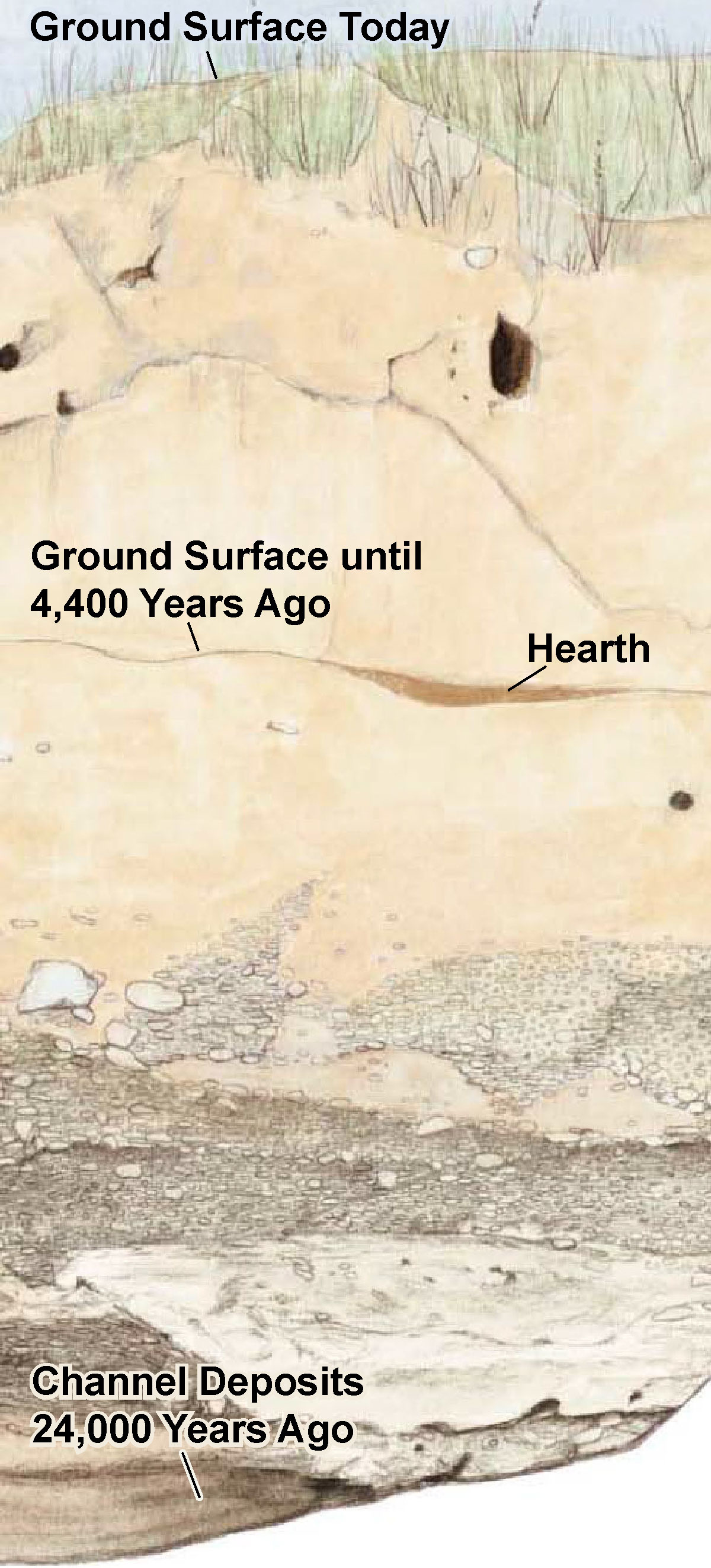
The deep cut along both sides of Marsh Creek is a snapshot of geologic time. The slice at the bottom was actually the ground surface 24,000 years ago, during the last Ice Age – at a time when glaciers covered much of the
Over the next 10,000 years the glaciers in the Sierra Nevada Mountains began to melt, sending water down the rivers and out to the ocean. The rising waters flooded a landscape populated with mammoths, camels, and giant ground sloths. It was probably toward the end of this era that the first people arrived in California.
The Marsh Creek channel may not have always been in its present location. Evidence suggests that it once flowed around the south side of the Marsh house, and cut its present course north of the house about 3,000 years ago.
Geologists have identified at least three cycles of significant sediment deposition (or floodplain building) in central California, separated by long periods when the land was stable. Each cycle created a new ground surface and buried portions of the old. In this way, the landscape became a kind of layer-cake of buried surfaces and archaeological sites. As Marsh and other creeks cut down through these sediments, they reveal layers of time in their banks.